Showing posts with label 2011 Flood. Show all posts

Friday, June 24, 2011

2011 Flood - Friday

Pictures coming home.

Farmers Field across from Atchison.  Where is the water coming from?

Another field across from prior picture

Same field as above.  The water is very close to this house.

Water level is down some.  Another levee broke north of us.

More of the bench to see today.

I think this is how the field by the house is getting flooded.

Looks like the Missouri flowed over the embankment and into the fields. 
I wonder if this is how 59 highway will flood.  When/if this happens, I will have to drive to Leavenworth to get to work.  Right now, it costs me over $10.00/day to drive to work.  If I have to go through Leavenworth will it cost me $20.00/day? 

Thursday, June 23, 2011

2011 Flood - Thursday

OMG  What a change since I last took pictures.


Those two blobs are the top of the bench.


Only one blob visible.  The current shifted.

Sidewalk covered.


New marker to watch the water level with.

To the left of the metal is the boat ramp.

Parking area for the boat ramp.

Road I usually travel on.

Beautiful pic.  Poor business.

People would park beside these trees and watch the river.

Blockade


Wednesday, June 22, 2011

2011 Flood - Wednesday


 I went home another back way.  I think Friday will be the last day to drive this road, a because the water is right at the edge of the road in a few places. 
This is a fishing/camping area.  Enlarge the picture and you can see the Utility post way out in the water.
Another Camping/Fishing area.

And another fishing/camping area.  Look at that car port.  There were two benches close to the water.  Now, they are either gone or under water.

Behind this barn is the farmer's field.  Look close and you can see the tree line almost under water that separated his field from the Missouri River

Another field flooded.

Tuesday, June 21, 2011

2011 Flood - Tuesday

I decided that taking the same pics every day would get old.  Sometimes there just isn't much of a change.   So I came home and then decided to take pictures of the closed road.  Lets see the differences now.
You can see the water from Independence Creek has flooded over.  To the left is the Levee.

You can see the water clearly here, and the Fallen tree.

Flooded Road.  A LOT more water than last time. 

Independence Creek Bridge.  Look at the water level!

This is actually a road.  Looks more like a stream.  WOW!

Here's the Tree.  Quite a difference.
One thing that stuck me as I was taking the pictures is how peaceful it was.  No traffic noises, tires on gravel sounds.  Just a few birds calling out.  A variation on 'Beauty and the Beast'.

Monday, June 20, 2011

2011 Flood - Monday

I didn't take pictures over the weekend.  But Took a few Monday after work.
Water level is back up.

Bench is under water More.

Another spot to mark the water level.

Friday, June 17, 2011

2011 Flood - Friday

You can see the Crane they are using to build the new bridge.  And the height of the water


Look at the dip in the water.  See how fast it is running right now.

You can see how much the water has gone down. Still due to levee breaks.

Wednesday, June 15, 2011

2011 Flood - Wednesday


Two Levees broke north of us.  Very sad that that happened.  It caused our section to go down, as you can see by the bench photo.

Monday, June 13, 2011

2011 Flood - Monday

I am going to try to get some pictures every day.  A few will be consistent to catalog the rising water level.

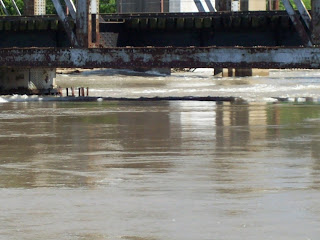
 Railroad Bridge
 Look at that current.  This picture turned out better than I thought it would!
 The Bench.  Look where the water is now!  You can just see a bit of grass through the water.
 Trees by the Independence Creek Bridge.
 Fallen Tree.  The water is a LOT higher.
 Here is the road.  Water is definitely deeper.

DON'T drive through water!!