Tuesday, June 21, 2011

2011 Flood - Tuesday

I decided that taking the same pics every day would get old.  Sometimes there just isn't much of a change.   So I came home and then decided to take pictures of the closed road.  Lets see the differences now.
You can see the water from Independence Creek has flooded over.  To the left is the Levee.

You can see the water clearly here, and the Fallen tree.

Flooded Road.  A LOT more water than last time. 

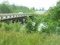
Independence Creek Bridge.  Look at the water level!

This is actually a road.  Looks more like a stream.  WOW!

Here's the Tree.  Quite a difference.
One thing that stuck me as I was taking the pictures is how peaceful it was.  No traffic noises, tires on gravel sounds.  Just a few birds calling out.  A variation on 'Beauty and the Beast'.

Monday, June 20, 2011

2011 Flood - Monday

I didn't take pictures over the weekend.  But Took a few Monday after work.
Water level is back up.

Bench is under water More.

Another spot to mark the water level.

Friday, June 17, 2011

2011 Flood - Friday

You can see the Crane they are using to build the new bridge.  And the height of the water


Look at the dip in the water.  See how fast it is running right now.

You can see how much the water has gone down. Still due to levee breaks.

Wednesday, June 15, 2011

2011 Flood - Wednesday


Two Levees broke north of us.  Very sad that that happened.  It caused our section to go down, as you can see by the bench photo.

Monday, June 13, 2011

2011 Flood - Monday

I am going to try to get some pictures every day.  A few will be consistent to catalog the rising water level.

 Railroad Bridge
 Look at that current.  This picture turned out better than I thought it would!
 The Bench.  Look where the water is now!  You can just see a bit of grass through the water.
 Trees by the Independence Creek Bridge.
 Fallen Tree.  The water is a LOT higher.
 Here is the road.  Water is definitely deeper.

DON'T drive through water!!


Sunday, June 12, 2011

2011 Flood - Saturday

 Tree has fallen into the Independence Creek because the roots/ground too water-logged.   These pictures are taken Sunday Morning as I go into Atchison.
 Sunday Morning.  Water is over the road.  Not too deep, was able to drive through it without much water kicking up.
 Path down to Missouri River.  Now flooded.
 This is the second lowest spot.  It is already starting to cross over the road.
 Boat Dock.  The River is higher and faster than Friday.
 RR Bridge.  Click on pictures to enlarge them.
 Look at the current.
Water is closer to the Bench today.
Getting ready for flood at Veterans Park.
 Missouri River in the background.
 Not sure why this is coming out of the ground.  Good Water Marker though.
Water is definitely deeper than when I came into town.  They are now barricading the River Road.  I'll have to go the long way into town and on to work, now.  
 Navy Memorial
 Closer look at rising water.  Really sprayed from the tires as I drove across for the last time.  Until it is either re-opened or if there is a lot of damage, repaired.
 Independence Creek Bridge.  Water is higher.
 There is the tree.  More of it is under water now.
 This wild turkey isn't too worried!


Friday, June 10, 2011

2011 Flood - Friday

 This is taken as I head to work this morning.  The Missouri River is just at the edge of the road.
 I was so surprised to see this pile of sandbags!


What on earth is this???


Amelia Earhart Bridge

 Look, Giant Lego's!!!
 Sandbags in the daylight. Veterans Memorial in the background.


  Cement Lego wall.  Amazing.  I hope it doesn't have to be used.

 Boat ramp.  Look at the current.
 You can see how swift and dangerous the current is.
 Independence Creek filling up with Missouri River water.
 Independence Creek Bridge


You can see how the Creek is already so full of water.


Park Bench beside the river.  This is my "marker" to compare the river level.


 Geese Flying over the Railroad Bridge.


Close up of the Railroad Bridge.